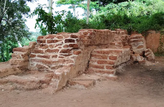
Kodungallur Fort
Kodungallur fort is one of the earliest Portuguese settlements situated on the West Coast, along with Fort Manuel (Fort Emmanuel) at Fort Kochi and Ayakotta at Pallippuram. Cranganor or Cranganore is the anglicized form of Kodungallur. The remnants of Kodungallur fort can be seen at the mouth of the river Periyar in the Thrissur district of Kerala.
It is important to note that the name "Kottapuram" fort is a misnomer for Kodungallur fort. In Malayalam, 'Kotta' means fort and 'Puram' means surrounding area. The area around Kodungallur fort is known as Kottapuram because of the fort's presence. Therefore, it is not "Kottappuram" fort.
Kodungallur fort was constructed by the Portuguese in 1536, originally known as the Fort of St. Thomas. Viceroy Dom Francisco de Almeida wrote to the Portuguese king as early as 1508, suggesting the construction of a fortress at Kodungallur, located alongside a river that connected to Calicut. He argued that such a fortress would effectively impede the flow of pepper from the river to Calicut. In 1536, during the governorship of Nuno da Cunha, the formidable fortress was built. Diogo Pereira was appointed as its first captain. The fort was later enlarged in 1565.
The Dutch traveler, Philip Baldaeus, noted that the Portuguese initially had only a tower, which they later reinforced with a wall, and eventually surrounded the entire area with well-constructed earthen fortifications.
In January 1662, the Dutch under the command of Van Goens captured the Kodungallur fort. "200 Portuguese being slain during the action, besides a great number of Nairs who were all thrown into the river, and carried backwards and forwards several times by the tides, a most terrible spectacle to behold," describes Dutch Captain Nieuhoff. "After the city was plundered it was laid level with the ground, except one stone tower, which standing upon the river, was preserved intire, and a garrison put into it for the security of the river."
In 1789, the Dutch sold the fort of Kodungallur and the post of Ayakotta (Pallipuram fort) to Raja Rama Varma of Travancore, which served as a catalyst for Tipu Sultan's invasion of Travancore in 1789-90. During the April 1790 invasion of Travancore, Tipu Sultan captured the Kodungallur fort and the Ayakotta post.
What we see now is a wall of the fortification about 60-70 yards in length, a ruined gateway and an underground powder magazine, all situated on a mound of earth.
At the fort entrance, there is a small granite pillar called the Ko-thi Kallu, which was erected to mark the boundary between the Kochi and Thiruvithamkoor (Travancore) principalities. The letters 'Thi' are engraved on one side to represent Travancore and 'Ko' on the other side for Kochi.


Comments